Mosaicing from Web tiles servers
The mosaic function let us download map tiles from Web Map Tiles servers given a BoundingBox limits in geographical coordinates. The function has many use options and we will show here the result of using some of them. By default it downloads images from the Bing servers but data from OpenStreetMap, Google, ESRI, Nimbo and other providers can be accessed as well.
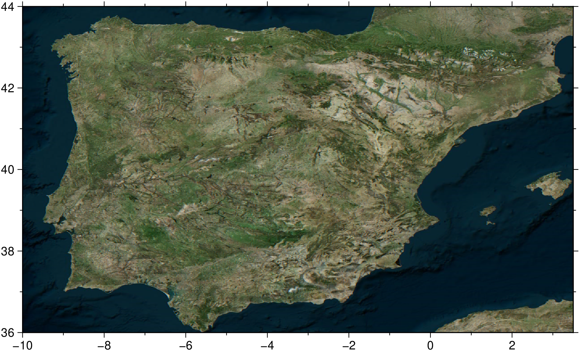
To start with we create an image over Iberia using only default values. i.,e. Bing images and image resolution (that is, the zoom level) computed automatically for that area.
using GMT

I = mosaic([-10, 3.5], [36.0, 44])
viz(I)
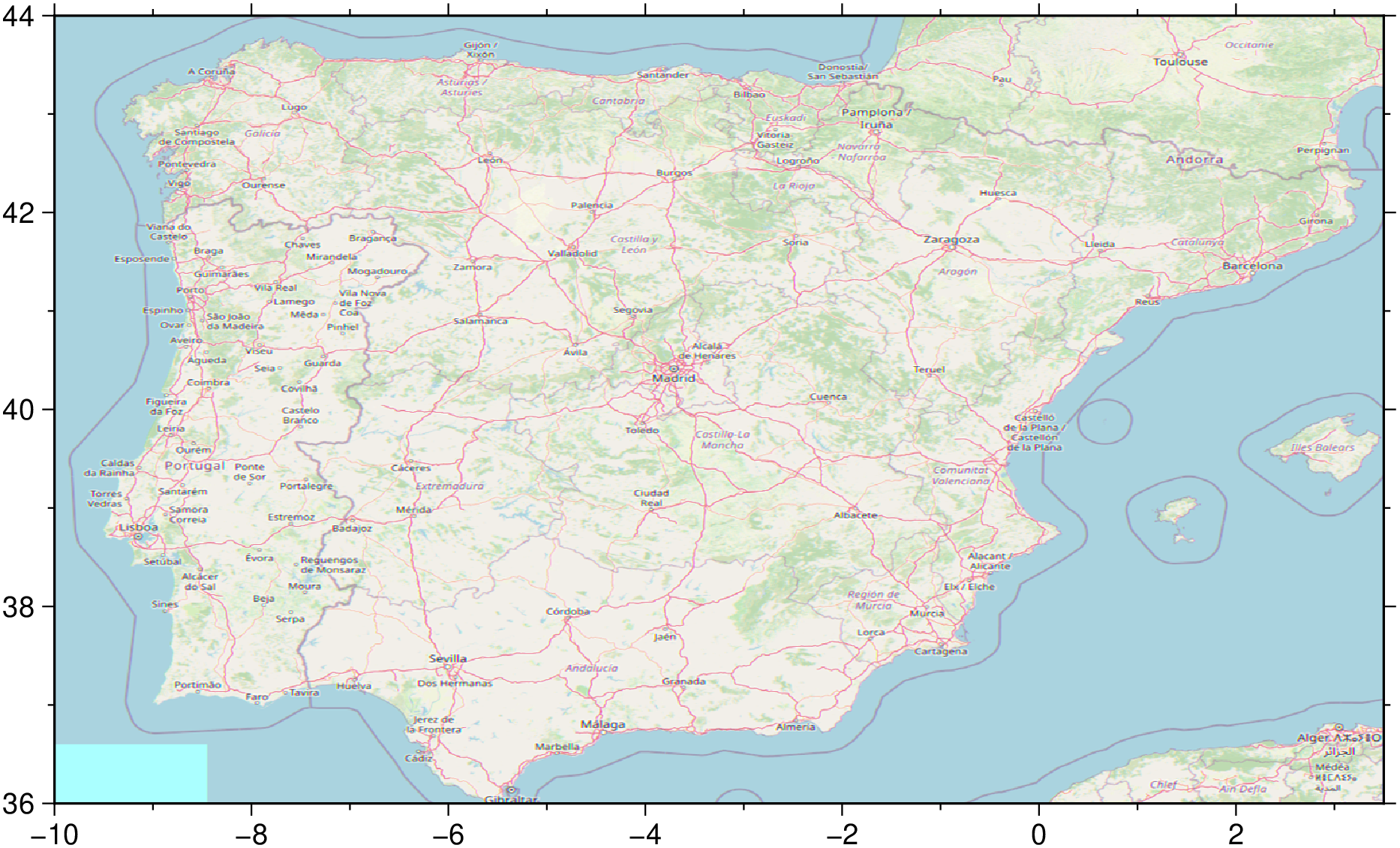
If we want instead a map from OpenStreetMap, we need to specify that via the provider option. To know more about the provider usage, see the manual of the getprovider function (e.,g._ type ? getprovider in the Julia command window.)
using GMT

I = mosaic([-10, 3.5], [36.0, 44], provider=:OSM)
viz(I)
A question that will often arise is: but what if I want to control the resolution, what zoom level should I choose?. Well, the answer is using trial an error or help yourself a bit and make a figures with the tiles limits. For that we use the mesh option and plot the tiles limits only.
using GMT

D = mosaic([-10, 3.5], [36.0, 44], mesh=true)
viz(D, coast=true)
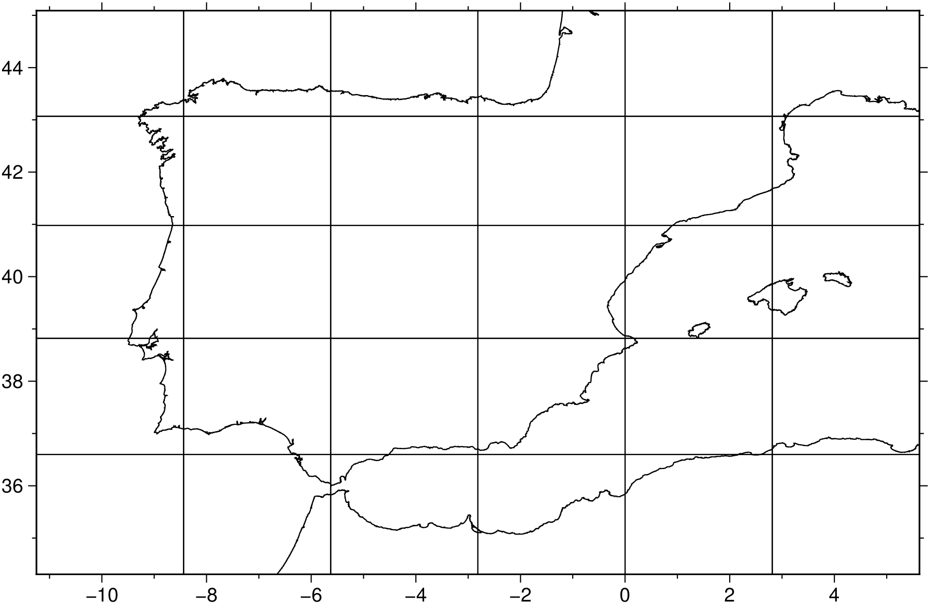
Typing D[1].comment shows that the default zoom level for that area is 8
julia> D[1].comment
1-element Vector{String}:
 "Zoom level = 8"`
So, if we want a twice resolution map we would do (for the first example). Mind you that each increase of one unit in the zoom level duplicates the resolution and multiply by 4 the number of download tiles.
I = mosaic([-10, 3.5], [36.0, 44], zoom=9)
viz(I)
So, we saw how to make maps over large areas, but when it comes to smaller areas it becomes more (or much more) cumbersome to find the appropriate map limits. That is when the geocoder function comes into our rescue. Basically, it takes as input an address and return a GMTdataset with information on that place, and in particular its coordinates and BoundingBox.
The syntax is very simple. Just give an address that it understands. It can be a general address like:
D = geocoder("Hawaii Island, USA")

Attribute table
┌────────────┬──────────────┬────────┬────────────────┬────────────┬───────┬────────────────────┬──────────────┬────────┬──────────┬───────
│        lat │ country_code │   type │ ISO3166-2-lvl4 │ place_rank │ class │         importance │          lon │  state │ osm_type │ addr ⋯
├────────────┼──────────────┼────────┼────────────────┼────────────┼───────┼────────────────────┼──────────────┼────────┼──────────┼───────
│ 19.5895548 │           us │ island │          US-HI │         17 │ place │ 0.5331294636028157 │ -155.4486983 │ Hawaii │ relation │      ⋯
└────────────┴──────────────┴────────┴────────────────┴────────────┴───────┴────────────────────┴──────────────┴────────┴──────────┴───────
                                                                                                                          8 columns omitted
BoundingBox: [-155.4486983, -155.4486983, 19.5895548, 19.5895548]
Global BoundingBox: [-156.0618813, -154.806698, 18.9106939, 20.2685021]
PROJ: +proj=longlat +datum=WGS84 +units=m +no_defs

1×2 GMTdataset{Float64, 2}
 Row │      Lon      Lat
─────┼───────────────────
   1 │ -155.449  19.5896
Since this still represents a somewhat large area we will use the reported BoundingBox via the bbox option. So, to create an image of the Big Island, Hawaii we do:
using GMT

D = geocoder("Hawaii Island, USA");
I = mosaic(D, bbox=true);
viz(I)
But when it comes to image real small areas the BoundingBox trick no longer works because it normally is ... too small. We must than use the alternative, which is to specify the number of neighbor tiles around the obtained address. And here we must specify the zoom level manually.
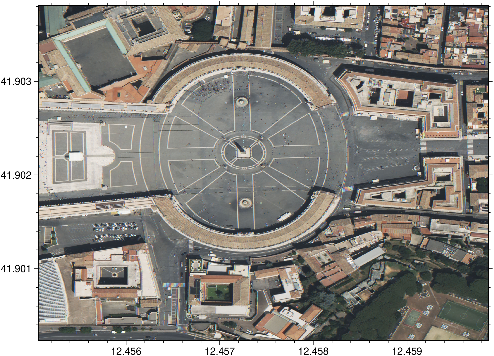
Example of a high-resolution map over the S. Peters Piazza, Vatican.
using GMT

D = geocoder("Piazza San Pietro, Vatican");
I = mosaic(D, zoom=19, neighbors=7);
viz(I)
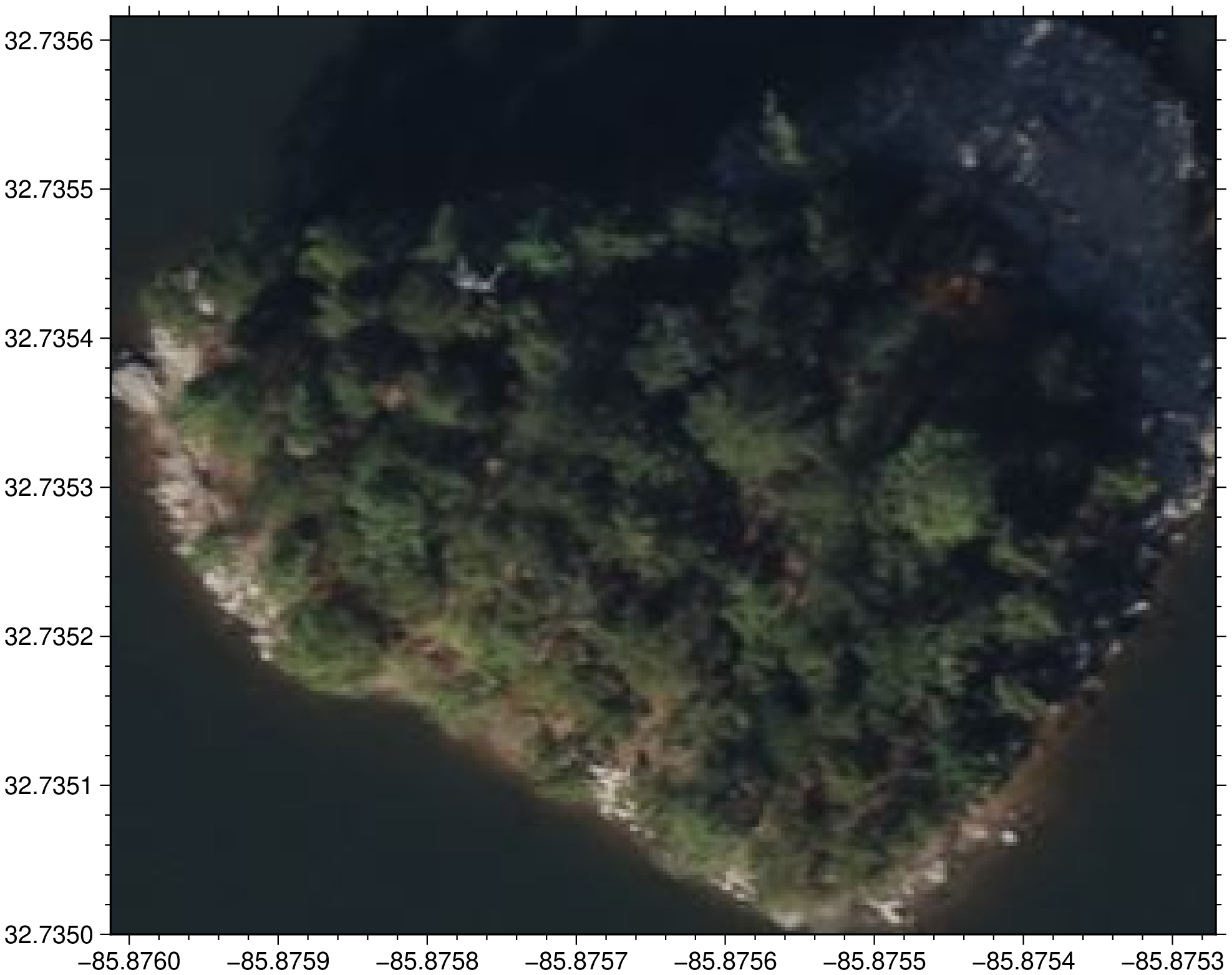
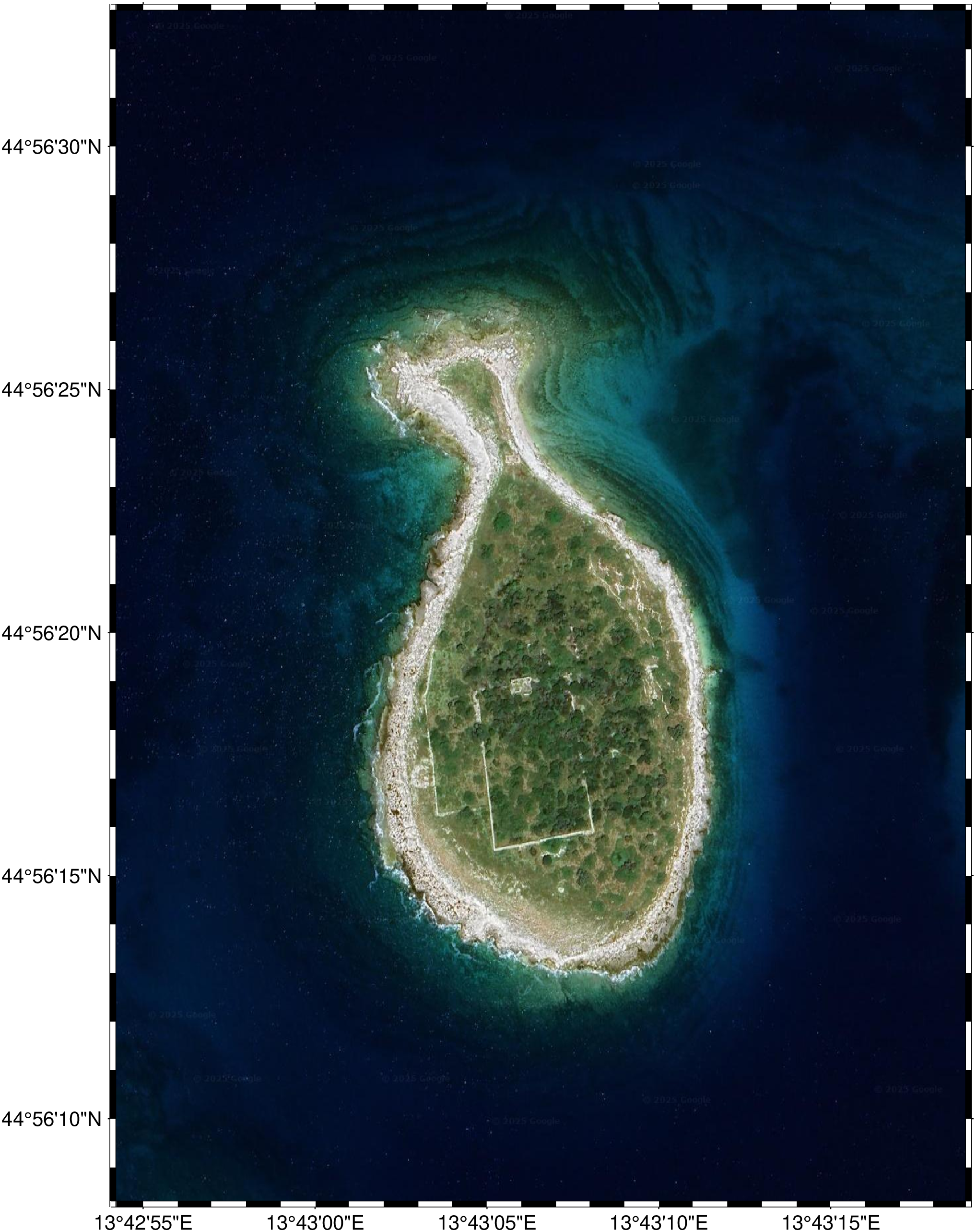
But not all small and beautifull places are geocoded. To see the lovely Fish Island in Croatia, we still have to provide the central coordinates (or the right BoundingBox).
using GMT

I = mosaic(13.71862, 44.939234, zoom=18, provider=:Google, neighbors=[7,5]);
viz(I, proj=:guess)
These docs were autogenerated using GMT: v1.12.2