Examples
Gallery
Tutorials
Geophysics
Documentation
Toggle menu
Navigation
Home
Examples
Color maps
Color maps
Årrows
Arrow examples
Feathers
Art
Art
Choropleths
Choropleths
Contour plots
Contours
Polar Contours
Embellishments
Map scales
Magnetic compass
Map insets
Frames
Frames
Draw Frames
Images
Color images
Perspective view
Plot surfaces
Pcolor
Hexagonal binning
Triplot
Web Map Service
Legends
Legends
Misc
Geodesic buffers
Plot on the sides of a cube
GADM
Annotations in geog maps
Plotting orbits
Plotting functions
Line plots
Filled curves
Stairs
Stems
Plotyy
Radar plots
Bar plots
Scatters
Stat plots
Error bars
Spirals
Symbols & Linestyes
Patterns & trasparency
Histograms
Plot3d
Projections
The true Hello World
GMT Map Projections
Best rectangular world map projection
Mixing UTM and geographic axes annotations
Subplots
Subplots
Ternary plots
Ternary plots
Themes
Theming
Gallery (Classic)
Contour maps
(2) Image presentations
(3) Spectral estimation and xy-plots
(4) A 3-D perspective mesh plot
(5) A 3-D illuminated surface (in bw)
(6) Plotting of histograms
(7) A simple location map
(8) A 3-D histogram
(9) Time-series along tracks
(10) A geographical bar graph plot
(12) Optimal triangulation of data
(13) Plotting of vector fields
(14) Gridding of data and trend surfaces
(15) Gridding, contouring, and masking of unconstrained areas
(16) Gridding of data, continued
(17) Images clipped by coastlines
(18) Volumes and Spatial Selections
(19) Color patterns on maps
(20) Custom plot symbols
(21) Time-series of RedHat stock price
(22) World-wide seismicity of last month
(23) All great-circle paths lead to Rome
(24) Data selection based on geospatial criteria
(25) Global distribution of antipodes
(26) General vertical perspective projection
(27) Plotting Sandwell/Smith Mercator img grids
(28) Mixing UTM and geographic data sets
(29) Gridding spherical surface data using splines
(30) Trigonometric functions plotted in graph mode
(33) Stacking automatically generated cross-profiles
(34) Using country polygons for plotting and shading
(35) Spherical triangulation and distance calculations
(36) Spherical gridding using Renka’s algorithms
(40) Line simplification
(41) Legend with tables
(42) Antarctica and stereographic data
(44) Map insets
(45) Trend modeling
(46) Day-light terminators and other sunlight parameters
(48) Line networks, map embellishments, and curved titles
Geophysics
Earth tides
Earth tides
Seismic¡ty
Focal mechanisms
3D models with side walls
Global seismicity
Tutorials
ISC
Landsat8
Plot Landsat 8 images
Coastlines
Coastlines and borders
dlakelan
Figure insets
Figure insets
Longest sail
The longest sail
Mosaicing from Web tiles servers
Mosaicing from Web tiles servers
Leland Brown's "texture shading"
Leland Brown's "texture shading"
Reading, filtering and visualizing geospatial vector data
Reading, filtering and visualizing geospatial vector data
Documentation
All documentations
Manuals
Common features
Vector Attributes
Setting color
Line decorations
Setting fonts
Justify
Pen attributes
Symbols
theme
Units
Common options
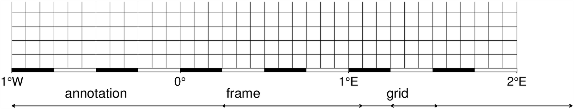
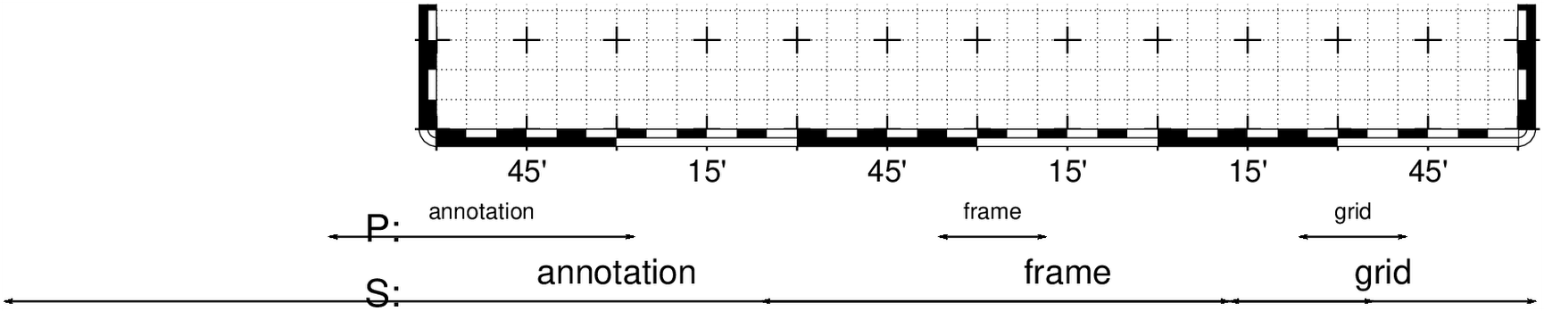
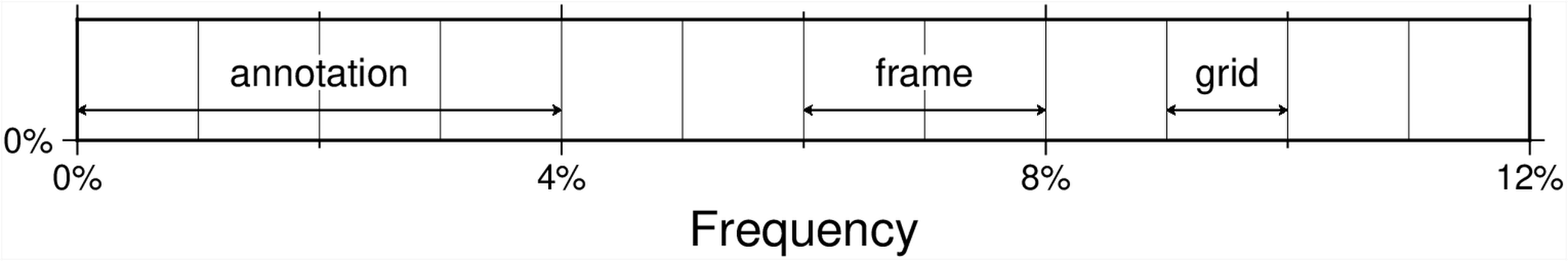
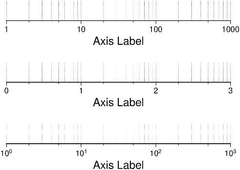
frame
General
Introduction
By Modules
Monolithic
Quick learn
The GMT.jl types (important)
GMT Modules
band
bar
bar3
basemap
blockmean
blockmedian
blockmode
boxplot
bubblechart
clip
coast
colorbar
contour
contourf
cornerplot
earthregions
ecdfplot
feather
fill_between
filter1d
fitcircle
gmt2kml
gmtbinstats
gmtconnect
gmtconvert
gmtmath
gmtselect
gmtset
gmtsimplify
gmtsplit
grd2cpt
grd2kml
grd2xyz
grdclip
grdcontour
grdcut
grdedit
grdfill
grdgradient
grdhisteq
grdimage
grdinfo
grdlandmask
grdmask
grdmath
grdpaste
grdsample
grdtrack
grdtrend
grdvector
grdview
hband
histogram
image
inset
legend
lines
makecpt
marginalhist
mask
movie
nearneighbor
parallelplot
plot
project
qqplot
quiver
radar
rose
sample1d
scatter
scatter3
seismicity
solar
sphinterpolate
sphtriangulate
stairs
stem
subplot
surface
ternary
text
trend1d
trend2d
triangulate
triplot
trisurf
vband
violin
wiggle
xyz2grd
GDAL related functions
Supplements modules
Utility functions
Utilities
ODE2ds
ablines
append2fig
blendimg!
cart2pol
cart2sph
coastlinesproj
colorzones!
cpt4dcw
crop
cubeplot
date2doy
delrows!
df2ds
doy2date
gadm
geocoder
geodetic2enu
getbyattrib
gmtread
gmtwrite
graticules
gridit
gunique
hlines
image_alpha!
image_cpt!
imagesc
imshow
ind2rgb
info
inpolygon
inwhichpolygon
isnodata
lelandshade
linearfitxy
logo
magic
mat2ds
mat2grid
mat2img
mosaic
orbits
pca
pcolor
plotgrid!
plotlinefit
plotyy
polygonlevels
rasterzones!
regiongeog
rescale
sealand
slicecube
sph2cart
stackgrids
streamlines
theme
uniqueind
vecangles
vlines
weather
whereami
wmsinfo
wmsread
wmstest
worldrectangular
worldrectcoast
worldrectgrid
xyzw2cube
zonal_stats
Interoperability with (some) other packages
Comparison with other plotting packages
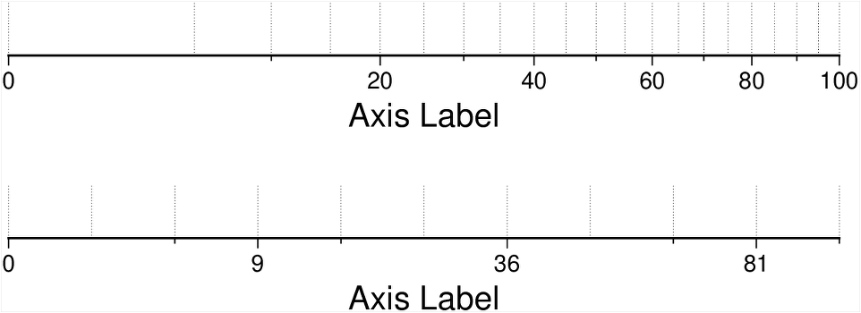
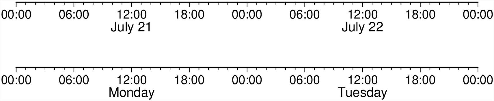
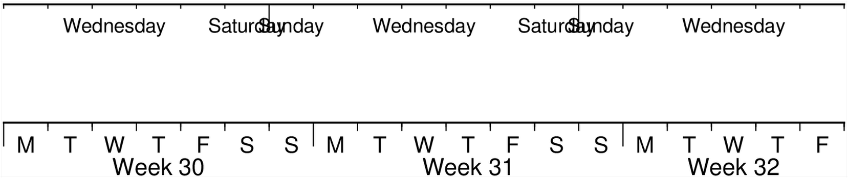
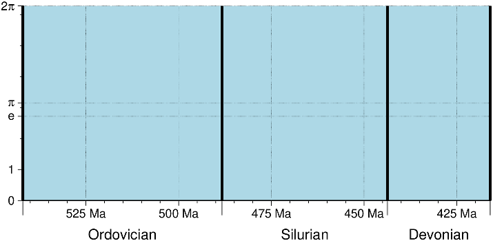
Frames
Draw Frames
© GMT.jl. Last modified: July 26, 2024. Website built with
Franklin.jl
and the
Julia programming language
.
These docs were autogenerated using GMT: v1.16.0