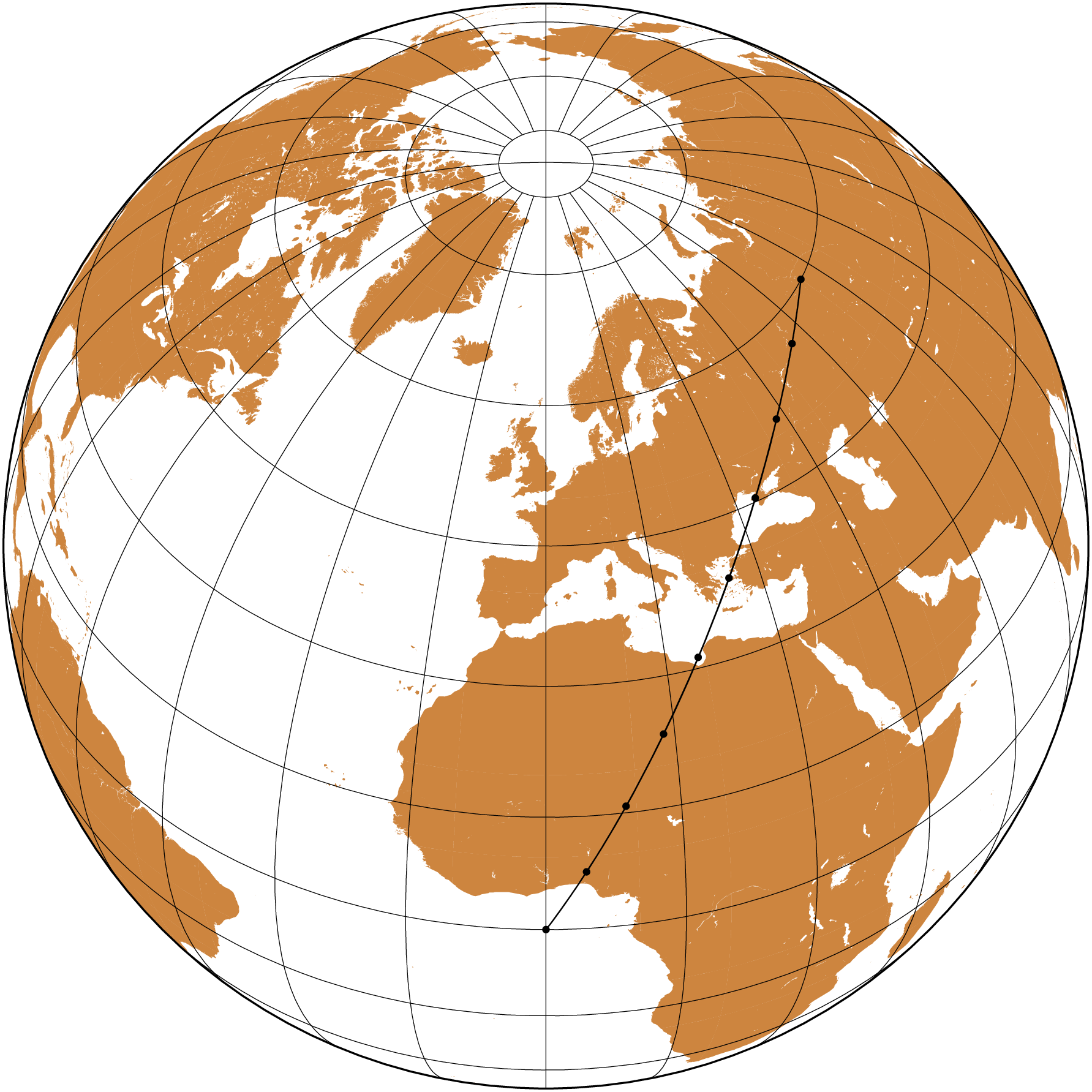
Buffers polygons delimite areas that are within some distance of input features. We can have them arround points or lines. We will show here examples of both.
We start by computing a great circle, also known as an orthodrome between two points and interpolated at 1000 km increments.
usingGMT# Compute the great circle (orthodrome) lineortho =orthodrome([00; 7060], step=1000, unit=:k);# Plot the orthodrome on an orthographic projectioncoast(region=:global, proj=(name=:ortho, center=(0,45)), land=:peru, frame=:g)plot!(ortho, lw=0.5, marker=:circ, ms=0.1, fill=:black, show=true)
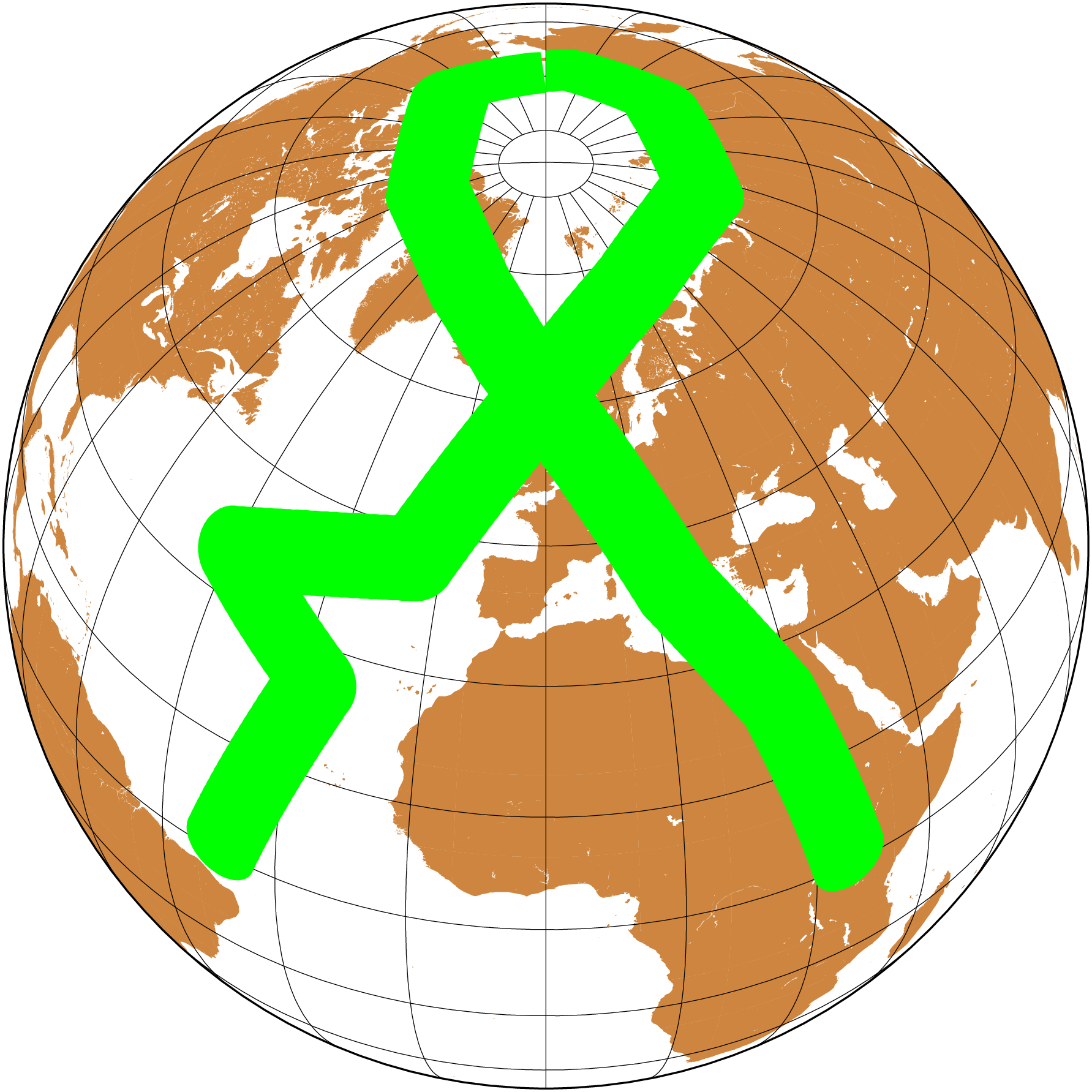
Next we will draw geodesic circles with 500 km radius with center on the orthodrome vertices. And to do it we need ofc to compute those circles. We compute the circles with the circgeo function.