inwhichpolygon (D:: Vector{GMTdataset} , point:: Matrix{Real} ; on_is_in= false )inwhichpolygon (D:: Vector{GMTdataset} , x, y; on_is_in= false )Finds the IDs of the polygons enclosing the query points in point. Each row in the matrix point contains the coordinates of a query point. Query points that don’t fall in any polygon get an ID = 0. Returns either an Int or a Vector{Int} depending on the number of input query points.
D: A Vector of GMTdadaset defining the polygons.point: A Mx2 matrix or a two elements vector with the x and y point coordinates.x, y: Specifies the x-coordinates and y-coordinates of 2-D query points as separate vectors (or two scalars).on_is_in: If on_is_in=true then points exactly on the border are considered inside. Default is false.
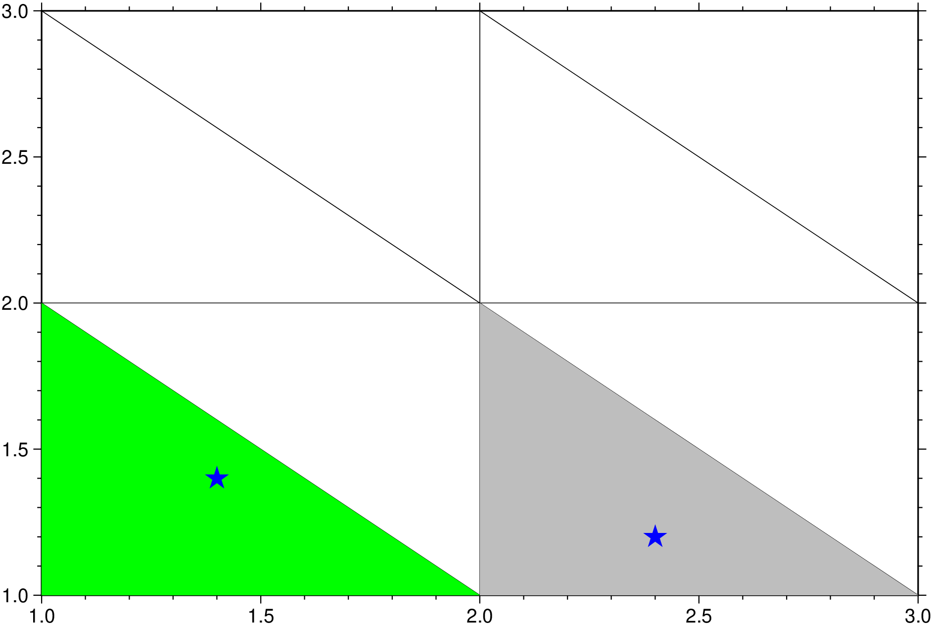
Examples
using GMT = [[1 2 3 ;1 2 3 ;1 2 3 ][: ] [1 1 1 ;2 2 2 ; 3 3 3 ][: ]];= triplot (pts, noplot= true );= [2.4 1.2 ; 1.4 1.4 ];= inwhichpolygon (points, D);# Plot the triangulation and the query points. plot (D)plot! (D[ids[1 ]], fill=: grey)plot! (D[ids[2 ]], fill=: green)plot! (points, marker=: star, ms= "12p" , fill=: blue, show= true )
Source Code
This function has multiple methods:
inwhichpolygon(Dpt::Vector{<:GMTdataset}, Dpol::Vector{<:GMTdataset}; on_is_in, pack)inwhichpolygon(point::VecOrMat{<:Real}, D::Vector{<:GMTdataset}; on_is_in, pack)inwhichpolygon(D::Vector{<:GMTdataset}, point::VecOrMat{<:Real}; on_is_in, pack)inwhichpolygon(point::Tuple{Vector{<:Real}, Vector{<:Real}}, D::Vector{<:GMTdataset}; on_is_in, pack)inwhichpolygon(x::Union{Real, Vector{<:Real}}, y::Union{Real, Vector{<:Real}}, D::Vector{<:GMTdataset}; on_is_in, pack)inwhichpolygon(D::Vector{<:GMTdataset}, x, y; on_is_in, pack)