NASA Mars Relief
Usage
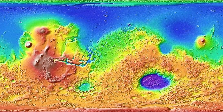
You access the global MOLA relief grid by specifying the special name
@mars_relief[_rru[_reg]]
This grid contains observed relief measured via altimetry. The following codes for the optional rru and reg are supported (dimensions are listed for pixel-registered grids; gridline-registered grids increment dimensions by one):
Code
Dimensions
Reg
Size
Description
01d
360 x 180
g,p
109 KB
1 arc degree Mars relief (MOLA @ 168 km)
30m
720 x 360
g,p
373 KB
30 arc minute Mars relief (MOLA @ 84 km)
20m
1080 x 540
g,p
781 KB
20 arc minute Mars relief (MOLA @ 56 km)
15m
1440 x 720
g,p
1.3 MB
15 arc minute Mars relief (MOLA @ 42 km)
10m
2160 x 1080
g,p
2.8 MB
10 arc minute Mars relief (MOLA @ 28 km)
06m
3600 x 1800
g,p
7.5 MB
6 arc minute Mars relief (MOLA @ 17 km)
05m
4320 x 2160
g,p
11 MB
5 arc minute Mars relief (MOLA @ 16 km)
04m
5400 x 2700
g,p
16 MB
4 arc minute Mars relief (MOLA @ 11 km)
03m
7200 x 3600
g,p
28 MB
3 arc minute Mars relief (MOLA @ 8.4 km)
02m
10800 x 5400
g,p
61 MB
2 arc minute Mars relief (MOLA @ 5.6 km)
01m
21600 x 10800
g,p
228 MB
1 arc minute Mars relief (MOLA @ 2.8 km)
30s
43200 x 21600
g,p
822 MB
30 arc second Mars relief (MOLA @ 1.4 km)
15s
86400 x 43200
g,p
2.7 GB
15 arc second Mars relief (MOLA @ 0.7 km)
12s
106694 x 53347
p
3.1 GB
12.14… arc second Mars relief (MOLA original)
Note that resolutions 05m and higher are tiled. See Remote Datasets for more information.
See GMT remote dataset usage for when resolution codes are optional or required.
All of these data will, when downloaded, be placed in your ~/.gmt/server directory, with
the mars_relief files being placed in an mars/mars_relief sub-directory. If you
do not specify a CPT then the default CPT for this dataset (the GMT master @mars_relief.cpt CPT) will be used.
Technical Information
As you see, the 01m and lower resolutions are all derivatives of USGS’ 12.1468873601 arc-second Mars_HRSC_MOLA_BlendDEM_Global_200mp_v2.tif (Neumann_et_al., 2003). We have downsampled it via Cartesian Gaussian filtering to prevent aliasing while preserving the latitude-dependent resolution in the original 12.1468873601 arc sec grid. The full (6 sigma) filter-widths are indicated in parenthesis. Almost all grids are available in both gridline- and pixel-registered formats except the original pixel-registered grid at 12.1468873601 arc-seconds resolution (here called @mars_relief_12s). Data resolution is 0.5 meter.
Data References
MOLA: [https://doi.org/10.1029/2000JE001426].