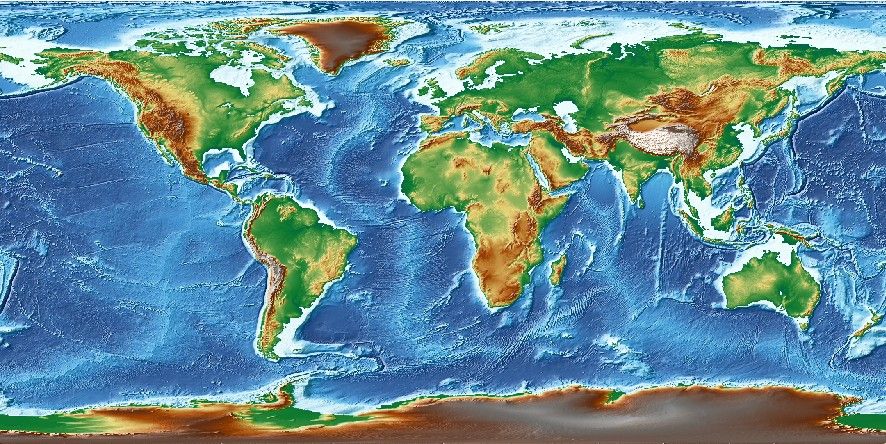
IGPP Earth Relief

Usage
You access a global relief grid by specifying the special name
@earth_relief[_rru[_reg]]
This grid only contains observed relief and inferred relief via altimetric gravity. A new version that uses the statistical properties of young seafloor fabric and directions of spreading is also available and provides more realistic relief in areas of young seafloor with small seamounts. That grid can be accessed via
@earth_synbath[_rru[_reg]]
The following codes for the optional rru and reg are supported (dimensions are listed for pixel-registered grids; gridline-registered grids increment dimensions by one):
Code
Dimensions
Reg
Size
Description
01d
360 x 180
g,p
111 KB
1 arc degree global relief (SRTM15+V2.7 @ 315 km)
30m
720 x 360
g,p
381 KB
30 arc minute global relief (SRTM15+V2.7 @ 157 km)
20m
1080 x 540
g,p
799 KB
20 arc minute global relief (SRTM15+V2.7 @ 105 km)
15m
1440 x 720
g,p
1.3 MB
15 arc minute global relief (SRTM15+V2.7 @ 79 km)
10m
2160 x 1080
g,p
2.9 MB
10 arc minute global relief (SRTM15+V2.7 @ 52 km)
06m
3600 x 1800
g,p
7.7 MB
6 arc minute global relief (SRTM15+V2.7 @ 32 km)
05m
4320 x 2160
g,p
11 MB
5 arc minute global relief (SRTM15+V2.7 @ 26 km)
04m
5400 x 2700
g,p
17 MB
4 arc minute global relief (SRTM15+V2.7 @ 21 km)
03m
7200 x 3600
g,p
30 MB
3 arc minute global relief (SRTM15+V2.7 @ 16 km)
02m
10800 x 5400
g,p
63 MB
2 arc minute global relief (SRTM15+V2.7 @ 11 km)
01m
21600 x 10800
g,p
233 MB
1 arc minute global relief (SRTM15+V2.7 @ 1.9 km)
30s
43200 x 21600
g,p
854 MB
30 arc second global relief (SRTM15+V2.7 @ 2.6 km)
15s
86400 x 43200
p
2.9 GB
15 arc second global relief (SRTM15+V2.7 original)
03s
432000 x 216000
g
6.8 GB
3 arc second global relief (SRTM3S original)
01s
1296000 x 432000
g
41 GB
1 arc second global relief (SRTM1S original)
Note that resolutions 05m and higher are tiled. See Remote Datasets for more information.
See GMT remote dataset usage for when resolution codes are optional or required.
All of these data will, when downloaded, be placed in your ~/.gmt/server directory, with
the earth_relief files being placed in an earth/earth_relief sub-directory and
the earth_synbath files in an earth/earth_synbath sub-directory. If you
do not specify a CPT then the default CPT for this dataset (the GMT master geo CPT) will be used.
Technical Information
As you see, the 30s and lower resolutions are all derivatives of Scripps’ SRTM15+V2.7 grid (Tozer et al., 2019). We have downsampled it via Cartesian Gaussian filtering to prevent aliasing while preserving the latitude-dependent resolution in the original 15 arc sec grid. The full (6 sigma) filter-widths are indicated in parenthesis. The 3 and 1 arc second data are the SRTM 1x1 degree tiles from NASA. Note: The 3 and 1 arc second grids only extend to latitudes ±60˚ and are only available over land. When these grids are accessed as @earth_relief_01s or @earth_relief_03s we will automatically up-sample the relevant @earth_relief_15s tiles to fill in the missing ocean values. If you just want the original land-only SRTM tiles you may use the special names @srtm_relief_03s or @srtm_relief_01s instead. Almost all grids are available in both gridline- and pixel-registered formats except the original pixel-registered SRTM15+V2.7 (here called @earth_relief_15s) and the gridline-registered SRTM tiles.
Data References
SRTM15+V2.7: [https://doi.org/10.1029/2019EA000658].
SYNBATH_V2.0: [https://doi.org/10.1029/2021EA002069].
SRTMGL3 tiles: [https://lpdaac.usgs.gov/products/srtmgl3v003].
SRTMGL1 tiles: [https://lpdaac.usgs.gov/products/srtmgl1v003].