CNES Earth Mean Sea Surface

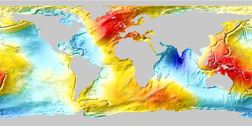
Geodynamics studies have an interest in the Earth’s Mean Sea Surface (MSS). CNES has provided such a grid post-processed by IGPP (Sandwell et al., 2022).
Usage
You access a global MSS grid by specifying the special name
@earth_mss[_rru[_reg]]
The following codes for rru and the optional reg are supported (dimensions are listed for pixel-registered grids; gridline-registered grids increment dimensions by one):
Code |
Dimensions |
Reg |
Size |
Description |
|---|---|---|---|---|
01d |
360 x 180 |
g,p |
82 KB |
1 arc degree global MSS (MSS @ 315 km) |
30m |
720 x 360 |
g,p |
245 KB |
30 arc minute global MSS (MSS @ 157 km) |
20m |
1080 x 540 |
g,p |
500 KB |
20 arc minute global MSS (MSS @ 105 km) |
15m |
1440 x 720 |
g,p |
840 KB |
15 arc minute global MSS (MSS @ 79 km) |
10m |
2160 x 1080 |
g,p |
1.7 MB |
10 arc minute global MSS (MSS @ 52 km) |
06m |
3600 x 1800 |
g,p |
4.3 MB |
6 arc minute global MSS (MSS @ 32 km) |
05m |
4320 x 2160 |
g,p |
5.7 MB |
5 arc minute global MSS (MSS @ 26 km) |
04m |
5400 x 2700 |
g,p |
8.5 MB |
4 arc minute global MSS (MSS @ 21 km) |
03m |
7200 x 3600 |
g,p |
15 MB |
3 arc minute global MSS (MSS @ 16 km) |
02m |
10800 x 5400 |
g,p |
26 MB |
2 arc minute global MSS (MSS @ 11 km) |
01m |
21600 x 10800 |
g |
79 MB |
1 arc minute global MSS (original) |
Note that resolutions 05m and higher are tiled. See Remote Datasets for more information.
See GMT remote dataset usage for when resolution codes are optional or required.
All of these data will, when downloaded, be placed in your ~/.gmt/server directory, with
the earth_mss files being placed in an earth/earth_mss sub-directory. If you do not
specify a CPT, the default CPT for this dataset (the GMT master @earth_mss.cpt CPT) will be used.
Examples
To create a PDF map of the mean sea surface at 1 arc degree resolution, try:
gmt grdimage @earth_mss_01d -Baf -pdf earth_mss
Technical Information
We scale and reformat the original data to take up very little space so that downloads from the servers are as fast as possible. For the MSS grid this means we chose 0.01 m as the smallest data unit, which is well below the uncertainties in the model. Data are scaled and shifted to fit in a short integer grid that is highly compressed by netCDF lossless compression and chunking. The data are reported in meters.