NASA Earth Day/Night Images
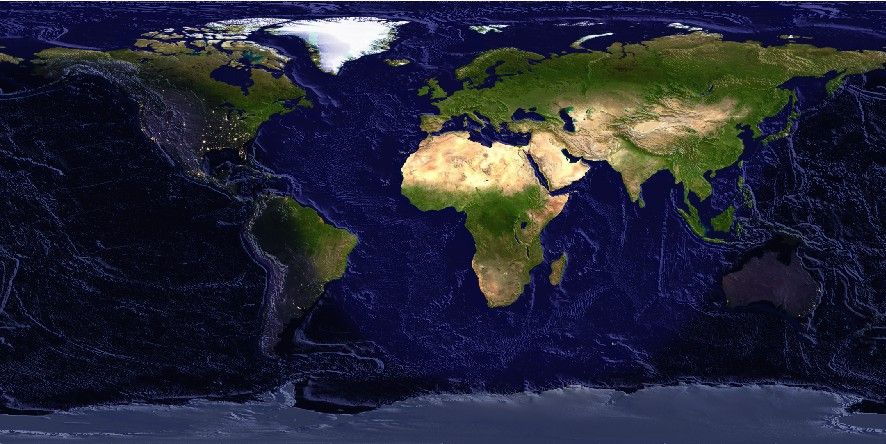
We serve two NASA image products: The Blue and Black marble mosaics. We have filtered and down-sampled those as well at the same resolutions that are available for the Earth DEMs. However, all images are pixel-registered only. These images may be plotted with grdimage or grdview and manipulated by grdmix. The above example mixes both images according to a day-night mask and adds illumination from a corresponding Earth DEM.
Usage
You access a global daytime image by specifying the special names
@earth_day[_rru]
Similarly for the nighttime view:
@earth_night[_rru]
The following codes for rru are supported. The sizes refers to the earth_day version (the earth_night ranges from 33% smaller for the highest resolution up to 44% bigger for the lowest resolution):
Code |
Dimensions |
Size |
Description |
|---|---|---|---|
01d |
360 x 180 |
73 KB |
1 arc degree image view (Blue|Black Marble mosaic @ 315 km) |
30m |
720 x 360 |
263 KB |
30 arc minute image view (Blue|Black Marble mosaic @ 157 km) |
20m |
1080 x 540 |
568 KB |
20 arc minute image view (Blue|Black Marble mosaic @ 105 km) |
15m |
1440 x 720 |
1.0 MB |
15 arc minute image view (Blue|Black Marble mosaic @ 79 km) |
10m |
2160 x 1080 |
1.9 MB |
10 arc minute image view (Blue|Black Marble mosaic @ 52 km) |
06m |
3600 x 1800 |
5.1 MB |
6 arc minute image view (Blue|Black Marble mosaic @ 32 km) |
05m |
4320 x 2160 |
7.2 MB |
5 arc minute image view (Blue|Black Marble mosaic @ 26 km) |
04m |
5400 x 2700 |
11 MB |
4 arc minute image view (Blue|Black Marble mosaic @ 21 km) |
03m |
7200 x 3600 |
20 MB |
3 arc minute image view (Blue|Black Marble mosaic @ 16 km) |
02m |
10800 x 5400 |
44 MB |
2 arc minute image view (Blue|Black Marble mosaic @ 11 km) |
01m |
21600 x 10800 |
171 MB |
1 arc minute image view (Blue|Black Marble mosaic @ 1.9 km) |
30s |
43200 x 21600 |
622 MB |
30 arc second image view (Blue|Black Marble mosaic original) |
See GMT remote dataset usage for when resolution codes are optional or required.
All of these images will, when downloaded, be placed in your ~/.gmt/server directory under
the earth/earth_day and earth/earth_night sub-directories.
Technical Information
The 01m and lower resolution images are derivatives of NASA’s Blue and Black marble image mosaics. We have downsampled them via Cartesian Gaussian filtering to prevent aliasing while preserving the latitude-dependent resolution in the original images. The full (6 sigma) filter-widths are indicated in parenthesis. The dimensions above reflect the number of nodes covered by the global images and the sizes refer to the geotiff “day” files on the remote server. Note: This data set is experimental and the format and delivery is likely to change in the future (e.g., via image tiles). To make the files as small as possible we have also downgraded them from 24-bit to 8-bit indexed images.